新闻搜索 新闻搜索 |
|
| 推荐图片 |
|
|
|
|
|
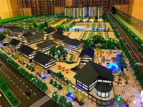
模型公司全分解沙盘模型全套工序流程 |
|
(时间:2020/3/9 11:16:11) |
随着改革开放和经济的不断发展,城市和地区建设日益完善。近年来,沙盘模型的制作也随之逐渐发展成为一种行业和技术,在作战指挥、演习、城市规划、资源开发,以及各种项目建设等领域中发挥了重要作用。
沙盘模型 城市规划 设计制作 城市规划 地物地貌 沙盘模型,从广义上讲是依照实物的形状和结构按照比例制成的实体,多用来展览和实验。从经济角度,多用于搞建设和开发,沙盘模型的种类繁多,基本上可分为单体沙盘模型和群体沙盘模型。本文所要探讨的“沙盘模型”即属于群体沙盘模型,不同的是,沙盘模型必须是以地形要素为基础,依据不同用途表现其专题要素。它是根据地形图等高线和各种符号,进行地形地貌的再恢复。杭州景文模型公司就本文如何采用新材料、新技术设计、制作沙盘模型,结合自己的经验谈几点体会。
沙盘模型制作
一、沙盘模型总体设计的原则及要求 根据客户需求和构思方案,沙盘模型的用途、表现形式及特点, 确定整个沙盘模型的最终表现效果。精心设计、制作,力求给决策者提供更方便、形象、精确直观的地理依据。
a、沙盘模型正确使用资料和合理确定比例。根据沙盘模型的区域范围和地理要点,合理确定沙盘模型的水平、垂直比例尺根据盘体的净面积和区域内容,确定制作方案。资料的利用原则:使用最新测绘图,要求内容新,现实性强,用以达到沙盘模型使用的超前性、长期性。基本资料可利用等大比例尺的地形图,补充资料可以利用不同比例尺的地图资料、卫星航摄像片、规划建设图纸、总图、建筑物平面图或立面图、渲染图,以及实地景物照片等。
1. 沙盘模型正确合理地处理各要素间关系
a. 地形要素中山体、水系、交通之间的关系要相容搭配,表现合理、自然,色彩搭配要协调,以便生动地反映实地的自然景观。
b. 居民地按照级别、比例关系处理。依比例表示的建筑物和街道、街区,依比例块状式街区,以及不依比例尺点状居民地。可根据不同的比例尺大小、居民地等级及重要性来选择不同的表示方法,并根据用途及要求确定表现手法。
c. 利用夸张的手法表示沙盘模型内绿化面积,增强整体效果。目前,城市规划逐渐趋于国际标准化,园林绿化环境已是城市规划建设的一项重要内容。
2. 周密地制定施工计划和合理安排施工步骤
a、前期的准备工作。包括材料、工具、资料和技术人员的准备工作,以及资料的技术处理和底盘的制作等。
b、安排施工阶段的主要工作。包括底盘的处理与纠正地形要素的建立各项专题要素的制作及电路系统的安装盘内装饰及分块盘体间各要素的衔接外包装的设计、制作等。按工序的先后与工作量的多少,合理安排工期。
C、整体的组装和调试工作。要求各部分拼装准确,总体效果表现协调一致,声、光、电、音同步,控制无故障。
二、沙盘模型制作的要求及表现手法
1.地貌要素山体沙盘模型按形式可分为普通式和梯田式山体沙盘模型。常用的材料有:人工胶合板、泡沫板、硬纸板、石膏,树脂等。制作形式以梯田式山体为主。其特点是能较好地反映等高线的主体效果,精度高,总体效果独特、生动、具体制作方法是:
a.根据垂直比例尺大小确定等高距、材料的厚度,以及基础等高线。
b.等高线的标描、复印与剪裁工作。用彩笔标描等高线并进行综合取舍,在强力海绵材料上复印等高线时要按由低到高的顺序,并标明层数交给下一步工序进行剪裁。
c.山体的粘接工作。用万能胶将第一层“梯田”按准确位置粘贴于底盘上,然后逐层进行叠加粘接,粘接过程中层与层之间要注意套合。不套合之处要随时用剪刀或手术刀进行修整,每层的小山头要及时粘贴上,以免遗漏或丢失。
d.水域、交通的镶嵌工作。根据用途需要选取重要或主要的水域,用蓝色有机玻璃板或喷漆处理的PVC板、按水系形状切割后进行镶嵌交通要素的选取则以高速公路、铁路、国道、省道、主要城际公路为主,道路网密度的确定要合理。表现方法是用珠光黑或珠光银、金色有机玻璃条受热软化沿走向镶嵌于山体之上表示道路。也可用PVC材料,表示色彩可用喷漆处理。注意道路与山体的相互关系处理要协调、自然。
e.植被采用装饰用植被草或海绵材料经磨制、染色而成的植被颗粒表示,用稀释乳胶喷洒固定,作业过程中要注意平地与山坡的植被配置过渡要自然,山的顶部、山谷、水域岸边和道路两侧要配以较深颜色、粗颗粒植被,用以增加林木感,以便更加生动地反映出实地的自然景观。
2.居民地依比例尺,建筑物的制作要根据建设设计施工图纸、渲染图,以及实物彩色照片进行加工制作。它的制作方法基本上有2种:
a.纯仿真式建筑物的制作大比例尺采用框架式内部结构,外表用仿真色彩的装饰材料进行粘贴,色彩与表面细部结构都与真实房体相同。小型房体可利用赛璐珞片或ABS板直接进行拼贴式粘接,色彩采用喷漆工艺处理。
b.喷沙工艺房体的制作采用纯色透明有机玻璃进行仿真制作,主要适用于中、小比例尺沙盘模型中房体建筑的制作,细部可以进行综合取舍,重点突出房体建筑的宏观形象和空间关系,表面用金刚沙喷沙工艺处理,效果为素白半透明状态。为突出重点,垂直比例尺可适度夸张。依比例块状街区和居民地也可用合适厚度的有机玻璃块并采用喷沙工艺制作,或者用合适厚度的黄色有机玻璃板制作,用以显示真实居民地的形状和范围。点状居民地可根据情况用4~6mm直径的白色钮扣状物表示。居民地名称的表示,采用可剥离胶片植字粘贴于0.5mm厚的白色有机塑料条上,置于居民地旁表示。沙盘模型
3.光电显示内容及形式街道路灯、重点区域范围线等,采用光导纤维作为发光器件,射灯为光源,以光源色彩区分内容。专题要素可用不同规格的发光二极管表示。光电控制系统可由人工控制开关或计算机系统控制,显示部分控制由计算机内存程序完成,并通过固态继电器等功放元器件输入显示单元。
4.语音系统简单语音系统可由录音磁带装置完成。高要求情况下,语音系统采用计算机语言设计语音程序,利用可读写光盘、光盘驱动器、功放和音箱,在计算机控制下完成搜索及播放工作。
5.控制方式分手控、遥控2种,手控采用普通开关或手控面板来控制。手控面板装置采用薄膜触压式开关,可安装在表面或盘体侧面,安装在侧面可采用滑道进行弹放输送。遥控方式为红外功能是完成除电源外的全部手控功能,遥控距离不超过8m。
6.沙盘模型基座及外包装目前主流的有木质和铝合金结构2种,铝合金结构重量轻不变形,效果极佳。盘面高度不超过1m,视觉最佳角度大约在20°~30°。外包装结构目前愈来愈趋于高档豪华型,可根据用户要求设计外包装类型,基本要求是外包装要与盘体搭配协调,外形美观、大方。
With the continuous development of reform and opening up and economy, urban and regional construction is becoming more and more perfect. In recent years, the production of sand table model has gradually developed into an industry and technology, playing an important role in battle command, exercise, urban planning, resource development, as well as various project construction and other fields.
Sand table model urban planning, design and production of urban planning features, landforms, sand table model, in a broad sense, is an entity made in proportion to the shape and structure of the physical object, which is mostly used for exhibitions and experiments. From the economic point of view, it is mainly used for construction and development. There are many kinds of sand table models, which can be basically divided into single sand table model and group sand table model. The "sand table model" discussed in this paper belongs to the group sand table model. The difference is that the sand table model must be based on the terrain elements and represent its thematic elements according to different purposes. It is based on the contour line of topographic map and various symbols to restore the topography. Hangzhou Jingwen Model Co., Ltd. discusses some experiences on how to design and make sand table model with new materials and technologies.
Sand table model making
1、 The principle and requirements of the overall design of the sand table model determine the final performance effect of the whole sand table model according to the customer's needs and conception scheme, the purpose, manifestation and characteristics of the sand table model. Elaborate design and production, strive to provide decision makers with more convenient, image, accurate and intuitive geographical basis.
a. Sand table model uses data correctly and determines proportion reasonably. According to the regional scope and geographical key points of the sand table model, the horizontal and vertical scales of the sand table model are reasonably determined, and the production scheme is determined according to the net area and regional content of the plate body. The principle of data utilization: using the latest mapping map requires new content and strong reality, so as to achieve the advanced and long-term use of sand table model. The basic data can use topographic map of the same scale, and the supplementary data can use map data of different scales, satellite aerial photography, planning and construction drawings, general drawings, building plans or elevations, renderings, and field scenery photos.
1. The sand table model correctly and reasonably deals with the relationship between various elements
a. The relationship among mountains, water system and traffic in terrain elements should be compatible, reasonable and natural in expression, and the color matching should be coordinated so as to vividly reflect the natural landscape on the spot.
b. The residential area shall be treated according to the relationship of level and proportion. Buildings, streets and blocks in proportion, block blocks in proportion, and point residential areas not in scale. Different representation methods can be selected according to different scales, grades and importance of residential areas, and the representation methods can be determined according to the purposes and requirements.
c. Exaggerate the green area in the sand table model to enhance the overall effect. At present, urban planning tends to international standardization, and landscape environment is an important part of urban planning and construction.
2. Make construction plan carefully and arrange construction steps reasonably
a. Preliminary preparations. Including the preparation of materials, tools, materials and technicians, as well as the technical processing of materials and the production of chassis.
b. Arrange the main work in the construction phase. It includes the processing of chassis, the establishment of terrain correction elements, the production of thematic elements, the installation of circuit system, the design and production of the inner decoration of the panel and the connection and outer packaging of the elements between the sub panels. Arrange the construction period reasonably according to the sequence of working procedures and the amount of work.
C. Overall assembly and commissioning. It is required that all parts are assembled accurately, the overall effect is consistent, sound, light, electricity and sound are synchronous, and the control is fault free.
2、 Sand table model making requirements and expression techniques
1. According to the form, the mountain sand table model of geomorphic elements can be divided into ordinary type and terrace type. Materials commonly used are: artificial plywood, foam board, cardboard, gypsum, resin, etc. The production form is mainly terraced mountain. Its characteristic is that it can better reflect the main effect of contour lines, with high precision. The overall effect is unique, vivid and specific production methods are as follows:
a. According to the size of the vertical scale, determine the contour distance, material thickness, and foundation contour.
b. Contour marking, copying and cutting. Use color pen to mark contour lines and make a comprehensive choice. When copying contour lines on strong sponge materials, follow the order from low to high, and mark the number of layers to the next process for cutting.
c. Bonding work of mountain. The first layer of "terraces" shall be pasted on the chassis according to the exact position with the universal adhesive, and then the stacking and bonding shall be carried out layer by layer. During the bonding process, attention shall be paid to the casing between the middle layer and the layer. Do not use scissors or scalpels at any time to repair the parts that do not fit, and paste the small hills on each floor in time to avoid omission or loss.
d. Mosaic work of water area and traffic. The important or main water areas shall be selected according to the needs of the use. The selection of inlaid traffic elements after cutting with blue plexiglass plate or painted PVC plate according to the shape of the water system shall be mainly expressway, railway, national highway, provincial highway and main intercity highway. The density of the road network shall be reasonable indeed. The way of expression is to use pearlescent black or pearlescent silver and gold plexiglass strips to represent the road along the direction of softening and inlaying on the mountain. PVC material can also be used, indicating that the color can be painted. Attention should be paid to the coordination and nature of the relationship between roads and mountains.
e. Vegetation is represented by vegetation particles milled and dyed with vegetation grass or sponge materials for decoration, which are sprayed and fixed with diluted latex
|
|
|
|
 |
 |
 |
 |
 |
|
|
|